Thursday, May 19, 2016
ESRI Powering Zika Disease Mapping Effort
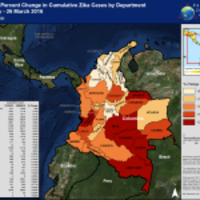 Redland-based geographical information systems (GIS) and mapping technology developer Esri says its mapping software is being used in an effort to map the Zika virus. According to Esri, the Pacific Disaster Center (PDC) is using the company's platform to track Zika on a global scale, mapping out reported and suspected cases of the disease. The PDC apparently is gathering updates and bullets from around the world to populate its online map.